Animal Rights Activists Uncover the Locations of Thousands of Factory Farms
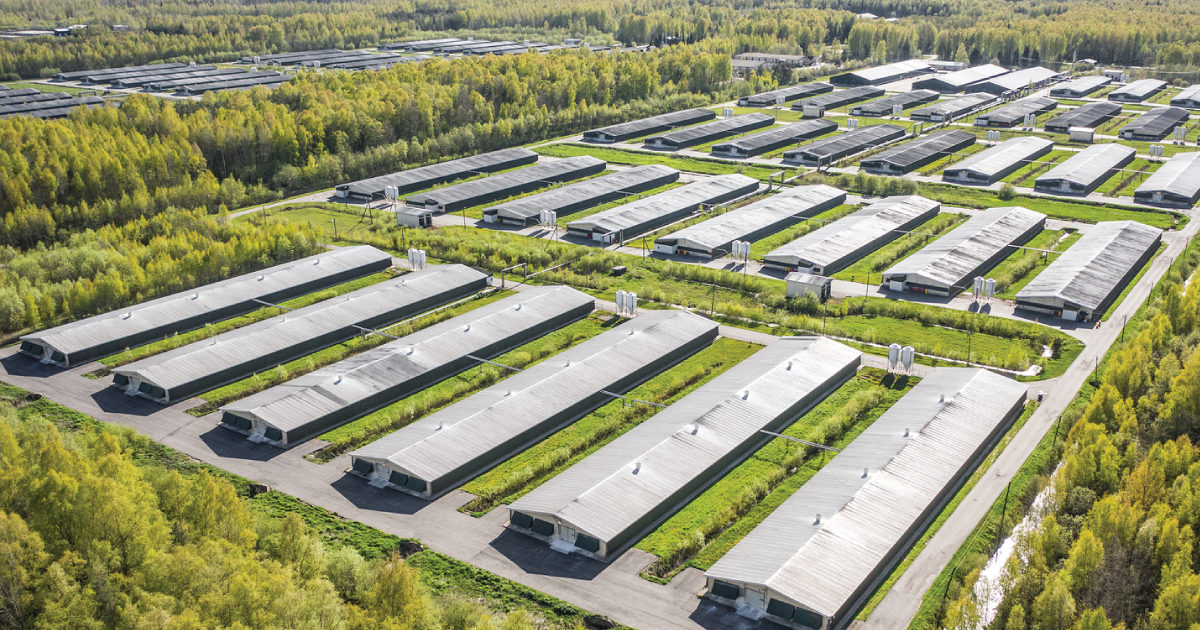
Animal rights activists published an interactive map on Sunday revealing the locations of more than 27,500 farms and animal agriculture facilities, including 5,812 identified using satellite imagery, many of which do not appear in public records.
May 31, 2020 | Source: The Intercept | by Alleen Brown
Animal rights activists published an interactive map on Sunday revealing the locations of more than 27,500 farms and animal agriculture facilities, including 5,812 identified using satellite imagery, many of which do not appear in public records. Users will be able to pin new locations to the map, known as Project Counterglow, and attach photos and videos documenting animal cruelty and health violations. The animal agriculture industry has spent decades fighting to avoid the disclosure of information about facilities where animals are raised for food.
The map is meant to offer a rare bird’s-eye view of the scale of the industry, while also providing a research tool for activist investigators. Kecia Doolittle, the leader of the team that created the map, is an animal rights activist who has participated in a number of farm investigations herself. Footage uncovered by Doolittle and others over the years has revealed conditions such as overcrowding; wounded, sick, and dead animals left in pens with the living; painful procedures like tail removal and castration without anesthesia; and physical abuse by farmers, at times resulting in boycotts or criminal charges.